There is a house on the Dutch–Belgian border with two addresses.
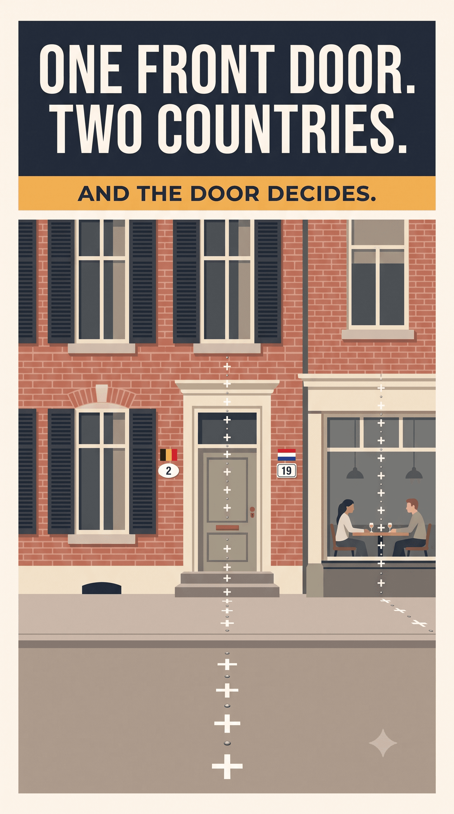
It is Loveren 2, in Baarle-Hertog, Belgium. It is also Loveren 19, in Baarle-Nassau, the Netherlands. The building is split down the middle: the Dutch heritage register records that the left-hand side belongs to Baarle-Hertog and the right-hand side to Baarle-Nassau, and protects only the Dutch half.
The border, the register says, runs through the middle of the front door — volgens de traditie. According to tradition. Even the state declines to claim it has been surveyed to the centimetre.
Which door it runs through matters more than you'd think, because in this town the front door is the rule.
The front door rule
Where your front door is determines which country you are registered in. That decides your municipality, and with it a great deal else.
This is not folklore. It is operative, and it has been enforced in both directions. When a resurvey in 1995 put one household's front door on the Dutch side of the line, the household moved the door back onto Belgian soil. Moving a door now requires a building permit, which is rarely granted — so the loophole that once let residents choose a country is effectively closed.
A house in Baarle is in two countries. A person in Baarle is in one, and a doorway decides which.
What Baarle actually is
Baarle is a single built-up town split between two municipalities in two countries: Baarle-Hertog, Belgian, and Baarle-Nassau, Dutch.
The Belgian municipality's own count is 30 enclaves: 22 Belgian enclaves inside the Netherlands, and 8 Dutch ones. Seven of those eight are true counter-enclaves — Dutch land inside Belgian land inside the Netherlands — sitting within the two largest Belgian enclaves. The eighth, Vossenberg, sits inside Zondereigen, which is Belgian territory attached to Belgium proper, so it is Dutch land inside Belgium and nothing deeper.
That Zondereigen detail also complicates the tidy version of this story: Baarle-Hertog is not only the scattered pieces in the town. It includes land several kilometres away that is joined to Belgium in the ordinary way.
The border runs through streets, gardens and buildings. It is marked with lines of small white crosses and metal studs set into the pavement. House numbers tell you the country: Belgian plates are oval and white with the tricolour printed in the corner, Dutch ones rectangular and white-and-blue.
How you get a town like this
Not from a war. From a feudal filing problem.
In 1198, Godfried II van Schoten, Lord of Breda, surrendered Breda to Henry I, Duke of Brabant, and received it back as a fief — along with scattered waste land, some of it at Baarle. What followed was centuries of land deals, divisions and grants between Breda and Brabant.
The criterion that produced the patchwork was tenure, not geography. The Duke of Brabant kept the plots that paid him rent and tax — the cijnsgoederen — and the plots he had granted to men guarding his territory. The uncultivated waste went to the Lord of Breda. Because rent liability followed individual holdings rather than contiguous blocks, the result was a scatter, and the scatter was never rationalised.
For centuries this was a property register, not a border. It became a border when the Low Countries split into separate kingdoms, and the old parcel list had to be converted into a line between two states.
It never was converted. When Belgium and the Netherlands settled their boundary in 1842–43, the commissioners could not agree a line at Baarle between boundary markers 214 and 215. So they gave up on drawing one and assigned nationality plot by plot — 5,732 individual parcels of land.
That is the actual origin of modern Baarle. Not a treaty that ratified the tangle. A treaty that failed to untangle it, and wrote the tangle down.
They did try. Repeatedly.
The comfortable version of this story is that nobody ever bothered to fix Baarle. That version is wrong, and the real one is better.
1785. A commission was formed under the Treaty of Fontainebleau. Protests from Baarle-Hertog stalled it, and then the French annexation ended it.
1830. A provincial border correction was informally agreed — and interrupted by the Belgian Revolution.
1875. A committee began exploring exchanges.
1892. The two states concluded a full boundary convention on 11 June, with a supplementary declaration in December, under which Belgium agreed to cede the disputed plots. The Belgian bill to approve it reached the Chamber — and lapsed in September 1894 without ratification.
1959. Belgium and the Netherlands litigated sovereignty over two plots at Zondereigen all the way to the International Court of Justice. The Court found for Belgium, ten votes to four, and expressly rejected the Dutch argument that the 1843 Convention had merely recognised a status quo.
1974. An official report delimited the Baarle-Nassau boundary at Turnhout — explicitly excluding the Baarle-Hertog enclaves, and leaving one parcel unallocated.
1995. The last contested parcel was finally allocated and the resurvey completed. This is the resurvey that moved a line past somebody's front door.
1996. Plans to merge the two municipalities were abandoned after both parliaments voted them down.
2014–15. The two municipalities moved to create a cross-border public body with legal personality, backed by the Governor of Antwerp and the King's Commissioner for North Brabant, and described as a step toward a single European municipality.
Nor is it true that these two countries can't trade territory when they want to. In 2016 they swapped land on the Maas near Eijsden — 16.37 hectares to the Netherlands, 3.08 hectares to Belgium — effective 1 January 2018.
So the honest answer to "why is it still like this?" is not indifference. It is two centuries of attempts that stalled, lapsed, were litigated, or were voted down — and, latterly, the fact that most people no longer see a reason to change it, because the strangeness itself is now the town's main attraction.
Living in it
The administrative consequences are the comic ones. Two municipalities means two mayors and two councils in the same few streets. (Though not quite two of everything: Baarle-Nassau's officials are pooled with two neighbouring Dutch municipalities in a joint organisation, and the two police forces share a single office.)
The anecdote everyone repeats is about closing time. Dutch restaurants once had to close earlier than Belgian ones, and a restaurant sitting on the line dealt with it by moving diners to a table on the other side of the room so the meal could continue.
We should be straight about this one: it is reported widely and an AFP feature confirms that different national closing times once made diners at a split restaurant move across the room. But the specific direction — Dutch closing first, diners moving to the Belgian half — traces back through Wikipedia to a travel blog, and at least one write-up claims the pull went the other way. It is a good story. It is not a well-sourced one, and we have not seen a primary record of it.
What is documented is that the two halves can genuinely diverge when the law differs. During the pandemic Baarle-Hertog locked down earlier than Baarle-Nassau; masks were required on one side of a street and not the other; and there were periods when a Belgian resident could not use the Dutch bar next door.
And one thing worth correcting about the "you can stroll across without noticing" version of Baarle: that is normally true, but the Netherlands reintroduced temporary controls on its Belgian and German land borders in December 2024, ran them until 30 September 2026, and replaced them on 1 October 2026 with an expanded mobile surveillance regime that can operate over a wider area near those borders. Baarle remains open and unfenced. It is not quite the frictionless picture it was two years ago.
Is there anywhere else?
Yes, though not deeper.
Nahwa is a village of about 300 people belonging to the Emirate of Sharjah, in the United Arab Emirates. It sits inside Madha, an exclave of Oman, which sits inside the UAE. UAE, inside Oman, inside the UAE, across roughly 4.4 square kilometres.
That makes Nahwa a second-order enclave — the same depth as the seven Dutch counter-enclaves at Baarle, not a step beyond them. The thing that was genuinely one level deeper was Dahala Khagrabari, the Indian field inside Bangladesh inside India inside Bangladesh, which is usually described as the world's only third-order enclave until it was exchanged in 2015.
Even that uniqueness has been questioned, and questioned at Baarle: enclave surveys have at times recorded a Belgian parcel inside a Dutch parcel inside a Belgian enclave here. Whether that configuration survived the 1995 resurvey, we have not been able to establish. We are telling you that rather than repeating a tidy superlative we can't stand behind.